[ad_1]

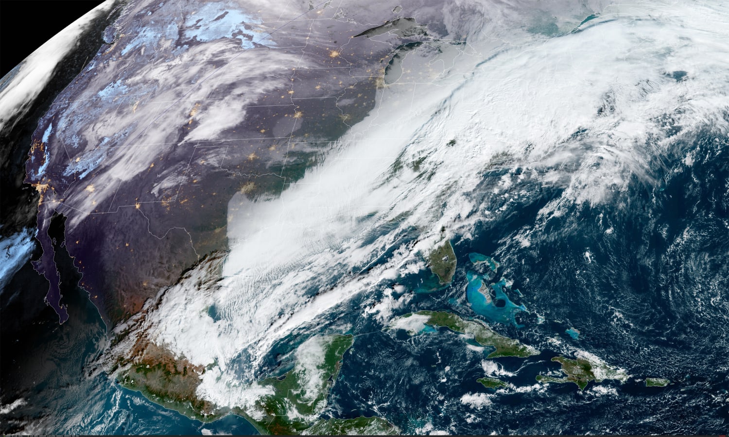
More than 20 million people are under some sort of winter storm watch or warning as heavy snow is expected to blanket parts of the Northeast this week.
The storm, which began Sunday in the Pacific Northwest, is forecast to produce not only significant snow in the Northeast, but also freezing rain and ice across portions of central Virginia and North Carolina.
Snow is expected in the Rockies and the central Plains on Monday and Tuesday, along with rain and storms across the southern Plains and the Southeast, according to the National Weather Service.
On Wednesday, the storm reaches the East Coast where it will draw moisture from both the Gulf of Mexico and the Atlantic Ocean, clash with cold air to the north, and strengthen into a coastal storm.
During the morning hours Wednesday, a mix of rain and snow will break out from Washington, D.C., northward while heavy rain and strong thunderstorms impact the Southeast to the coastal Carolinas during the afternoon.
By Wednesday night, areas from Washington, D.C., to Philadelphia may experience a mix of rain and snow, while New York City to Boston and locations across the interior Northeast will likely get snow. Snowfall rates will be heavy at times and gusty winds could cause whiteout conditions, power outages and dangerous travel conditions, the National Weather Service said.
On Thursday, snow is expected to continue through the morning hours for the Northeast and New England, but will taper off throughout the day.
A widespread 3-6 inches of snow is possible from central Virginia up through Maine. A swath of 6-12 inches, locally higher amounts, is currently forecast from Maryland up through southern Massachusetts, with the highest snow totals possible along or just west of the I-95 corridor. Travel is not recommended Wednesday or Thursday in those areas.
Meanwhile, Washington could receive as much as 6 inches of snow, Philadelphia and Boston up to 8 inches, New York City up to 12 inches. Those totals could end up being lower, especially in Philadelphia and Washington, where rain is also expected.
Still, this could be one of the biggest snowstorms in nearly five years to hit New York City. The last storm to drop 12 inches or more on the Big Apple was in January 2016. The last storm to cover the city in at least 6 inches was in November 2018.
One reason for the high confidence that this system will produce significant snow totals is that ample cold air is in place ahead of the storm, because of a strong area of high pressure over southern Canada keeping cold air locked in place. This has been a missing ingredient to winter storms over the last few years resulting in lackluster winter storms and resulting seasonal snow totals.
In fact, should this storm produce the amount of snow currently forecast, cities including Washington, Philadelphia and New York could pick up more snow with this storm than they did all of last winter which saw record-setting low amounts of snow.
During the 2019-2020 winter season, Washington’s 0.6 inches was the third least snowy winter, Philadelphia’s 0.3 inches was the city’s second least snowy winter, and New York’s 4.8 inches was its fourth least snowy winter on record.
[ad_2]
Source link