[ad_1]

Uttarakhand: 20 people have lost their lives and more than 200 are presently missing.
New Delhi:
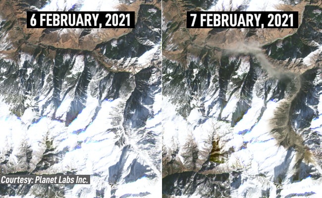
Medium resolution satellite imagery sourced by NDTV from Planet Labs. Inc show before and after images of the ridge-line near Joshimath from where ice, snow and rubble collapsed into the narrow river-valley of the Dhauliganga, a fast-flowing river that joins the Alaknanda river.
For high resolution photos, click here.
In the first image, dated February 6, the ridgeline appears intact while the image of February 7, taken shortly after the disaster struck, shows vast areas of the ridge-line bereft of snow and ice. Dust from the impact of ice and snow crashing into the river-valley are also clearly visible in the image of February 7.

Debris from the avalanche, widely reported to be a ”glacier burst” destroyed two hydel power plants a short distance away. 20 people have lost their lives and more than 200 are presently missing.
[ad_2]
Source link